Sunday, February 14, 2016

Passage to Maria la Gorda


I am in my bunk and the ship is rolling in heavy swells. The sun is finally up after a long passage out of Havana yesterday at mid day, but the cabin goes dark when the porthole goes below the waterline - it is very disconcerting. We are heading West to round the tip of Cuba, but the wind and swell is from the north and the geometry makes for a very rocky boat. Everything is creaking and groaning, with ominous bangs from the dining lounge above, and I am ready for all this to end. Soon, I do make it up to the lounge to attempt breakfast, as do about a dozen of the fifty passengers, but I give up and come back down after toast and yogurt. The crew has minimal breakfast available but has their hands busy with roping up the dining chairs to prevent them from doing any damage. My stomach is ok and I have my fingers crossed but am pleased with the performance of my wrist bands compined with drugs. It is nearly impossible to stand. Our guide Olga comes up and says that she feels like she is in a laundromat when she looks at her porthole - I agree.
Things do settle down after we round the point around 11 o'clock, but Olga announces over the PA that the port of Maria la Gorda is closed to all ships due to weather conditions, and so we groan and sail on to Cayo Largo, an additional 18 hours away. There is plenty of deck space and although the day is breezy,  it is now sunny and I will continue reading my book on the history of the Bacardi rum family. At 4:00, our Cuban guide Roberto promises to give a talk on 500 years of Cuban history, and I make a promise to myself to stay awake. He is a nice young man who works hard on his English but he has been seasick for a day so I don't know what to expect.

Sunday, December 13, 2015

Baracoa


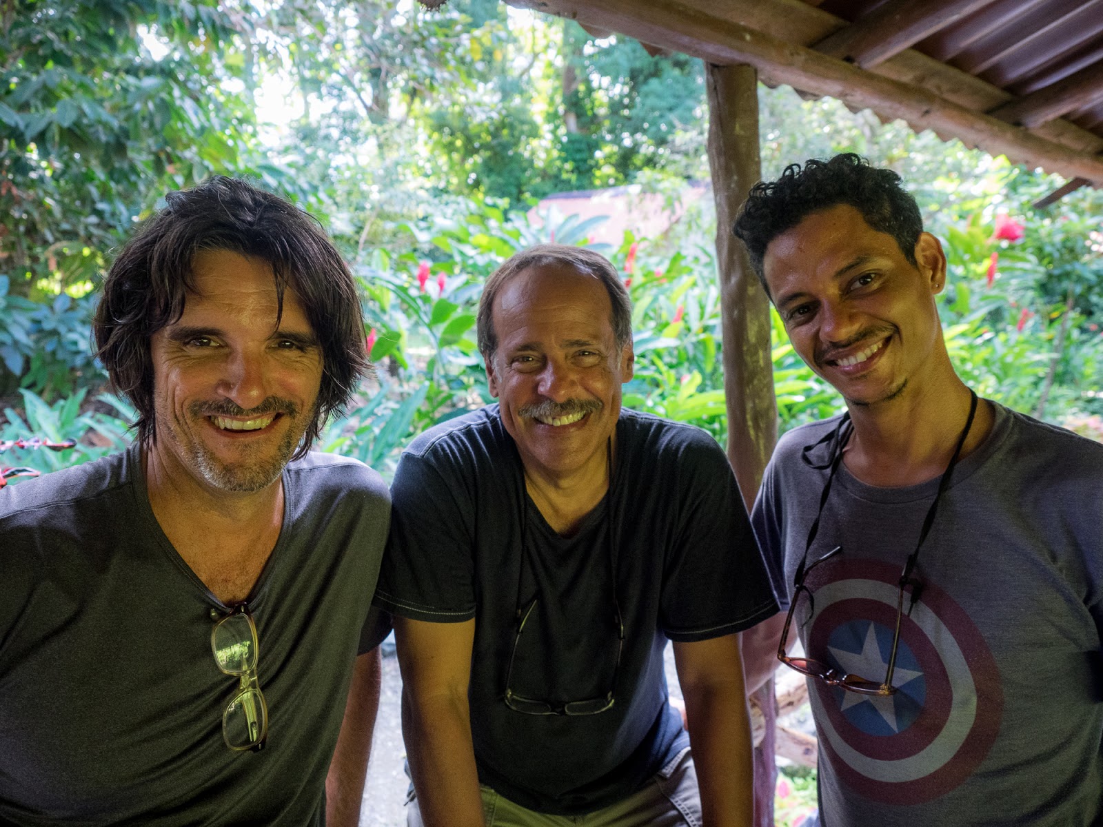
We are headed east to Baracoa – as far as you can go, and still be in Cuba. Columbus landed here in 1492 and it soon became the first capital of the Spanish colony. I am in a comfortable bus, handled by Enrique, a calm gentleman who navigates the winding road well. A lunch stop is welcome, at a beach with one shade tree in the sweltering heat. We are immediately greeted by an old man who has miraculously set up a shop under our tree featuring coconuts, which he splits with a battered machete. He also has shell necklaces, for a dollar each and they sell like hotcakes – he makes his profit on volume, no doubt.  Some of us decide to jump in the surf to cool off. Actually, just three – our Cuban photographic hosts cannot resist the temptation. Carlos Otero is a young Havana resident who is our inside man for this trip to the rural areas at the eastern tip of the island. He is drawn to the simple lives of the people here and has scouted the area by bicycle, making friends with people we will see soon. Jorge Gavilando is a retired doctor who had specialized in research into cancer immunology before transferring his passions to photography.  Arien Chang is young up and coming photographer who has become highly respected in the Havana photographic community. We are extremely fortunate to have them as our guides. Talented, warm, and funny.
(Carlos with rugged central-casting Latin looks, Jorge with his warm smile, and Chang working into one of his goofy looks)

Our diverse group of 15 is led by Arthur Meyerson, from Houston, who does stunning work and is a helpful, inspiring hand to all. Our next stop is a photo op at a huge sign proclaiming the entry into Guantanamo town, still about twenty miles form the US military base, but a reminder of the relationship between our two countries.

It is now dawn, and I walk around Baracoa. It is a tropical town with a definite Caribbean feel. The town is waking up, and the first harsh sunlight makes for some wonderful photographs.

The main forms of transportation here    include walking, horse drawn carriages, and bicycle taxis. I see very few cars and even fewer old American classics. This is not Havana. Some tourists have been discovering the town recently but the   transportation is used by all. The only place you cannot get to easily is our hotel - at the top of 88 steps to the lobby (the rooms are higher still). I have three short sleeved shirts with me and I soon realize that I need to cycle them through a morning, afternoon, and evening change of shirts in the sweltering humidity. 


Outside of Baracoa the countryside is scattered with small communities that struggle to get by supporting the coconut crop and harvesting from the government owned groves. Housing was extremely basic, but we did see electricity almost everywhere. Today, Carlos leads us to visit a family he knows, and he is greeted with a warm embrace by the father, who welcomes us in. The two sons are sent up a tree to gather coconuts and split them for the guests. The fruit is young and full of sweet coconut water and the interior is coated with sweet paste.                         

Carlos is inside the house, helping someone pose a shot of the father through the window opening, and I am outside with the two sons, seeing if I can get him to break character for an unguarded moment, but he mostly maintains his serious demeanor. Away from the camera, he is gentle, with an occasional soft smile. His sons are quite taken by all the attention and are happy to pose for me in a more natural way. The dog (I think it is a dog) gets into the act too.


Tuesday, November 10, 2015

Kyoto


The van from Osaka airport to Kyoto takes about two hours. The driver has a sharp looking uniform and cap,  and wears white gloves. Seats are protected with white crochet covers and the van is spotless. Lisa and I are groggy from the 12 hour flight,  but I am peering out the window to get a sense of the surroundings, which right now is a huge highway and a mix of business signage in Japanese kanji characters, mixed with some unexpected English (Bowling!?!). It's Monday evening and the roads are full but the traffic is moving surprisingly smoothly, even in the light rain. When we get onto the streets of Kyoto, the rain picks up considerably and the people in the crosswalks are dashing, with umbrellas leaning forward into the rain. The driver who speaks a little English with a heavy accent, turns with a smile and says "catsanddogs".


Two weeks coming up in Japan and I have done a little flag study to get ready. Thankfully, his one is pretty easy; the flag represents the sun. Or, more specifically, the Sun Goddess Amaterasu, from whom the emperor traces his lineage. Oh, and the white background is representing purity. Simple.

- These are not quite so easy to interpret -


KYOTO
"The city emblem is composed of stylized kanji δΊ¬ KYO and an ancient style court carriage in gold and dull purple representing ancient capital of Japan." (I don't see the kanji character, no matter how hard I try.)


HIROSHIMA
"The city emblem was made to be inspired by the former Aki Clan lord’s flag design of three horizontal stripes and modified to wavy style. It represents river flow and the water city Hiroshima." (Nice graphic for a port city.)


OSAKA
"The main device of the emblem is a Miotsukushi used for a beacon in the shallows of Osaka. The prosperity of Osaka is greatly due to transportation by water. The Miotsukushi was chosen for the emblem as it is deeply connected with its port." (Makes sense if you know what it is. Otherwise...)

Wednesday, June 3, 2015

Carrizo

If you have ever wondered what might lie west of Bakersfield and east of the Pacific Ocean, the answer is “not much”, but I am on my way there now. Exiting off Interstate 5, the road is arrow straight through almond groves, over the California Aqueduct and past small signs posted by farmers urging politicians to “Solve the Water Crisis”. From a distance, the communities of Maricopa and Taft are green smudges on an otherwise arid landscape, peppered with oil wells. Oil is huge here, and the sign by the side of the road reminds me that I am on The Petroleum Highway. 
Soon, a left turn puts me on a delightfully curvy road, away from oil and through brown, hilly ranchlands, heading to Carrizo Plain National Monument. After a while, I pass a car headed the other direction, then one herd of cows, then two crows and twenty minutes later, another car. Carrizo Plain is an inland valley with a dry lakebed, little visited but well know to geologists for the interesting things the visible San Andreas Fault does as it skirts the valley. Here is also the community of California Valley, planned in the 1960's by optimistic real estate developers who didn't take water seriously into account. An extensive grid of roads and street signs never became the community that was envisioned. Today, the population is supposed to be 500, but as I drive in, I see a few lonely ranches, but no people until I reach the California Valley Lodge and the manager checks me in. Sixty five dollars in cash for the night, but he has to walk across the road to the auto repair garage to get change for me. I was prepared for a low key establishment – when I called a few months ago to reserve, I was advised to bring cash, as well as food (the restaurant has been closed for a while) and water (some people find the slightly alkaline well water objectionable).

I go for a short drive, scouting locations to photograph the full moon rise this evening and I see nobody on the road at all. I see an abandoned tractor, that has some promise as a photo foreground and find a small hill overlook that has a panoramic view of the whole valley. The sky is clear, and a little hazy which might make for a spectacular moonrise.

 After I walk to the top of the overlook and set up my gear, I photograph in solitude for about an hour an a half. The birds in the salt marsh have quieted down with the sunset and there is a coyote nearby who yips from time to time, but not one car drives by on the main road to spoil my shot.